Saturday, September 28, 2013

Just ambling along

We are just slowly ambling along taking in views where ever we are - which happens to be getting colder.


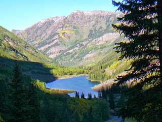
A rather nice valley encompassing the ghost town of Independence in Colorado in the Rocky Mountains.


Independence Pass 12,095ft the Continental Divide.

Twin Lakes.


Abraham Lincoln on a park bench in the skiing town of Steamboat Springs.


A big wall of dinosaur fossils at Dinosaur National Monument on the Colorado/Utah border. Thousands of dinosaurs died in a drought and later their  bones were washed together and fossilised in this one area, part of which has been made into a showcase.


Another wonderful piece of rock structure in the area, Split Mountain.


These photos above were taken in the Red Canyon of the Flaming Gorge in Utah.  The depth of the cliffs are 1700ft with the width about 4000ft.  We crossed back into Utah on our way back to the much warmer California coast.


Andrew standing on a ledge above the BIG drop.  Normally this would really freak me out but a photo op is a photo op :-)


Finger rock at Sheep Creek Canyon geological drive at Flaming Gorge.

Wednesday, September 25, 2013

Black Canyon of the Gunnison NP - an awesome gorge

Awesome it is.  It was named 'black' because its walls are so high and so sheer and the canyon so deep and narrow in parts that very little sunlight can penetrate.


We stayed at the camp site and it was cold.  Only 8,300ft (2536m).  But the day was clear and bright and we had a lovely time looking at these imposing chasms.  You can see most of the lookouts by driving around the rim and having short (300m) walk to the overlooks.


We did do a longer walk of about 3km to Warner's Point one of the highest points at the south rim of the canyon.  Like the Grand Canyon, the Black Canyon also has a south and north rim and it is about 80 miles of driving from one to the other.  We did drive, but it was on our way north, and while the views were amazing I nearly had heart failure from the sheer dropoffs.  Andrew is an excellent driver but my fear of heights is a big disadvantage for me - lessens the enjoyment a great deal.  And we are doing a lot of this sort of driving around the Rocky Mountains.

Maroon Bells National Forest, around Aspen, Colorado

Maroon Bells is just outside the skiing resort of Aspen.  We only heard about it from a fellow traveller and we visited and spent the night at the campsite.  It is a lovely drive in and the two lakes (Maroon and Crater) are delightful.


Maroon Lake in the late afternoon sun.  This is at an altitude of 9,850 ft (2880m).  Maroon Bells tower over the valley like massive sentinels.  The mountains' red colour and distinctive bell shape led early explorers to give the name to the them.


A view of the lake from higher up.  Andrew took the steep rocky climb up to Crater Lake but his photos of it were no comparison to Maroon Lake.


And a last one with the Maroon Bells.

Sunday, September 22, 2013

Autumn colours in the Rocky Mountains, Colorado

Autumn comes earlier up in the high country than it does lower down.  We are crossing the Rocky Mountains, in the San Juan region of Colorado on our way northwest.


When we reached the Molas Pass at 10,900ft (about 3,300m) there was snow on the ground and on the
mountains around.

Saturday, September 21, 2013

Mesa Verde, southern Colorado

Mesa Verde Spanish for ‘green table', is a national park which houses, preserves and displays pueblo dwellings which fill cliff-rock alcoves that rise 2,000ft above Montezuma Valley is southern Colorado.  

As well as the dwellings, the terrain of the park is stunningly beautiful with high cliffs long which it is hair-raising to drive.  The drive within the park is some 30-35 miles from one end to the other.  The campground is a nice one with hot showers and laundry facilities.  Deer graze in the grass next to your RV as you camp.


Remarkably preserved, these cliff dwellings cluster in canyons that slice the mesa into narrow tablelands.  Archaeologists have located more than 4,800 sites including 600 dwellings dating from about AD 550 to 1300.  The dwellings document changes in the lives of prehistoric people once called the Anasazi.  Now days they are more accurately called ancestral Puebloans.


Close up of the cliff face with the houses built in the crevices.


Friday, September 20, 2013

More of Utah

We next visited the Natural Bridges Monument, still in southern Utah.  How bridges and arches differ you may want to know.  Natural bridges are formed by the erosive action of moving water.  Arches are formed by other erosional  forces, mainly frost action and seeping moisture.  Those same forces also work to enlarge natural bridges once stream erosion forms them.


Natural Bridge National Monument is a small park containing three of the world's largest natural stone bridges.  Sipapu Bridge, Kachina Bridge and Owachomo Bridge - all are Hopi Indian names.  The 9 mile long one way Bridge view loop road  runs right around the park and leads to overlooks and trailheads right down  to the bases of  each of the  three bridges on the canyon floor.  

The photos above are of Sipapu Bridge, firstly from the roadside and then from the canyon floor.  The walk down to Sipapu Bridge was not a long one - about 1.5km but it was VERY steep with ladders and handrails over the steep rockface to get to the canyon floor.  


Owachomo Bridge from the roadside.  This bridge no longer straddles a stream whereas it was originally cut by the action of two streams.  It is really an arch now as the water presence has disappeared. 


and at the foot of the bridge on the canyon floor.


Newspaper rock is an art panel which represents multiple cultures, some of the carvings dating back some 1500 years while others were placed there at the turn of the 20th century;  The images on this large rock face are petroglyps.


The photo above is of the Goosenecks of the San Juan River.  The 1,000ft (305m) cliff rises above one of the most striking examples of an entrenched river meander in North America.  The river twists and turns through sinuous 'gosenecks' as it advances west on its journey to Lake Powell flowing over 6 miles (10km) while it advances to the west only 1 mile (1.5km).

We stopped for the night on the cliff top where we took the photograph.  These campers camped on the ledge below.


Our last stop in Utah this time around was at Hovenweep National Monument which preserves the dwellings of the ancestral Pueblo people.  Here are two style of houses.


Wednesday, September 18, 2013

Arches NP, Utah

Wind, water and time joined with geological phenomena to create  2,000 (plus or minus) named and catalogued arches.  An arch that exists today may crumble and no longer be there tomorrow.    New arches are constantly forming.  This concentration of arches is the greatest density of these formations in the world.  Many can be seen driving along the paved road while others are only accessible by a hike of various length and intensity.  Here are some of the spectacles in the park.


This is known as Park Avenue as the structures resemble buildings down an avenue.


                This one is the 3 gossips
.


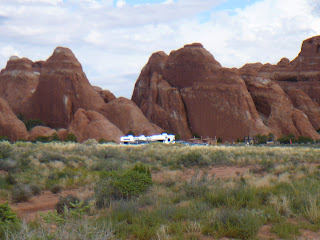
The Devil's Garden trailhead with the RVs parked in the parking lot.


and now some of the arches


Landscape Arch stretches over 300ft in length and is one of the longest arches around.


Delicate Arch is so synonymous with Utah that it is featured on the state’s lines plates.  To get to this arch one must conquer the elevation change – 480ft with no shade along the route.


Partition Arch.


Pine Tree Arch.


The top of the very beautiful Double O arch.


           North and South Windows.


North Window and that little figure there is Nikki.


Double Arch Bridge.